Take this 12 mile circular hike along the South Downs Way to Beacon Hill for 360 views and woodland magic …plus what to do if you get lost!
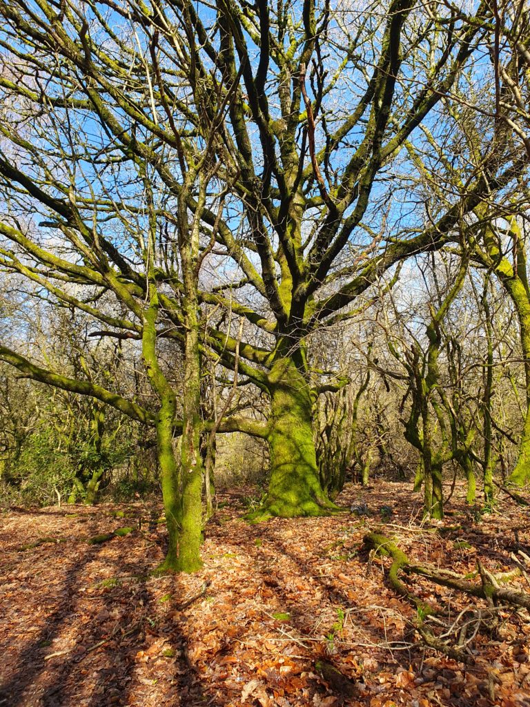
This is one of my favourite hikes taking in the quintessentially English countryside of the South Downs North of Chichester. You’ll walk along the chalk paths this area is famous for, take in breathtaking views all the way to the South Coast and the Isle of White and walk through a variety of woodland, giving you the opportunity to find a log to perch on and take in the birdsong.
How Long Will It Take?
If you’re speedy you could complete this hike in 4 hours. But this walk is an experience not a race: give yourself time to savour it. For me one of the beauties of walking is that it is slow travel. Time to unwind, reflect and breathe in nature while your stress filters out of your body and into the ground. So allow 5 to 6 hours to meander, stop and look around, have a picnic, spend 10 minutes forest bathing, write a poem, watch a buzzard hovering over a field, notice how the wind moves the grasses…you get the picture!
Quick Note
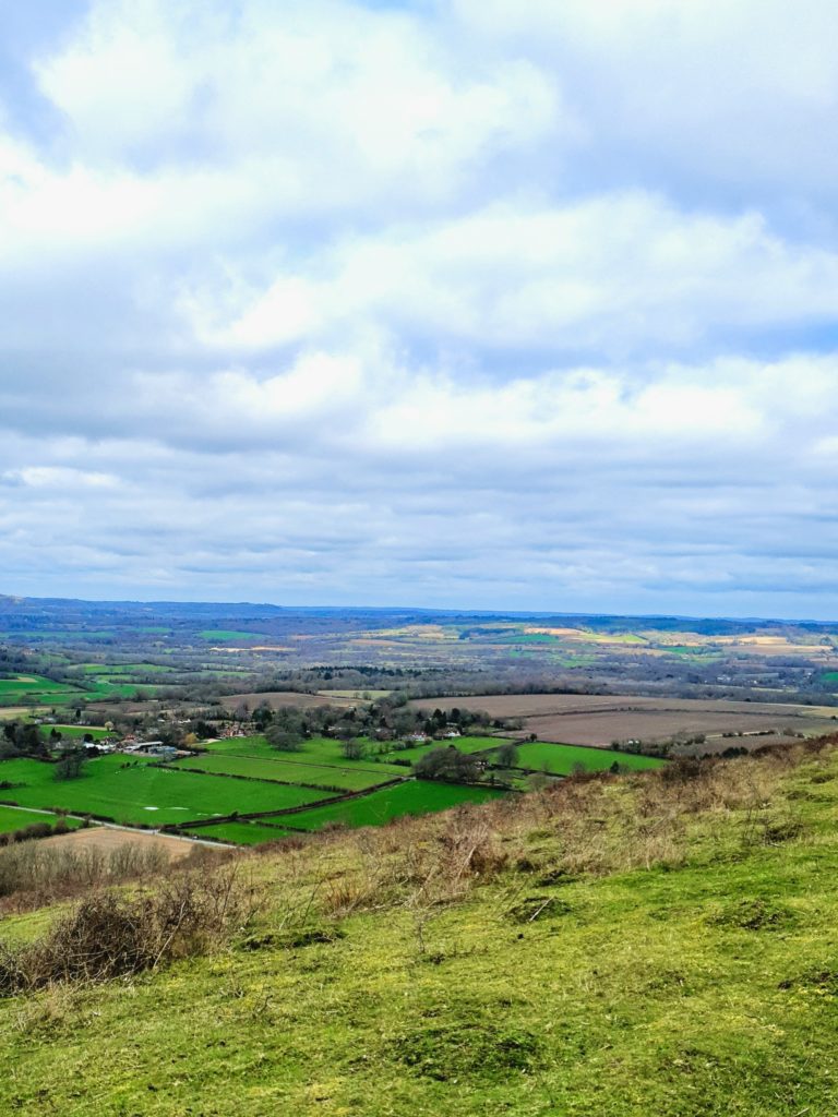
This is the South Downs and what goes down…err must go up! Most of the hills are gentle but there is one short but steep climb up to the top of Beacon Hill. This is an optional extra on the route but well worth it for birds eye views to the sea.
How to Plan Your Hike: Get A Map!
Yes I am describing the route here. But spending 10 minutes with a map before you go will give you a better appreciation of the lay of the land and a more active engagement in the countryside you are passing through. Plus you may see features on the map that interest you or that you want to avoid. Then you can easily amend the route to fit your likes and dislikes. Yes it’s an expense – around £8.50 at time of writing – but there are so many glorious walks in this area: you will get great value from your map. Plus if you’re nerdy like me you can get a highlighter pen and mark your walks on your map: very satisfying as you gradually cover the map with your lines!
The map you need for this route is OS Explorer OL8 Chichester, South Harting and Selsey. Buy it Online at Ordnance Survey shop or Amazon
THE MAP COMES WITH AN APP (So you won’t get lost)
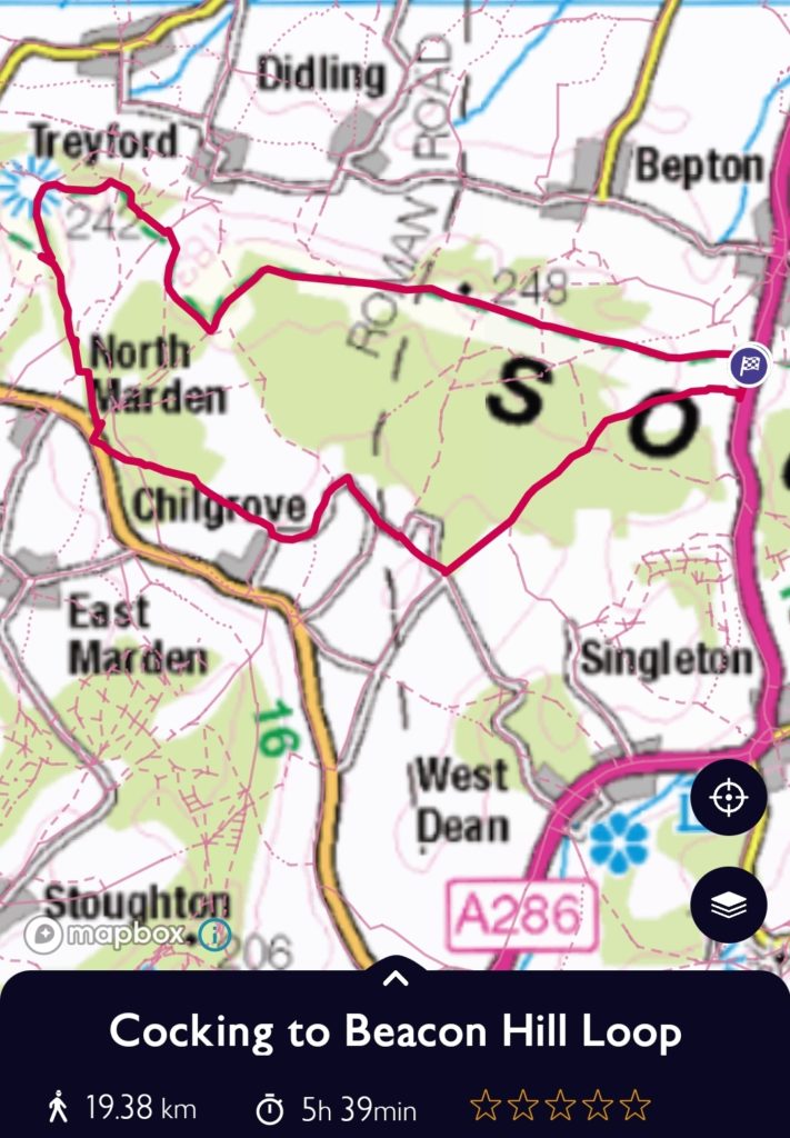
So this is the coolest thing about OS maps! When you buy the map it comes with a FREE mobile download of that area. This means you can plot your route and then track it as you go. NEVER GET LOST AGAIN! Seriously, this circular route looks really simple to follow – and it is. But if you’re like me then it’s easy to get distracted and just miss the path signs. My top distractions are:
- Talking! If I’m walking with friends we regularly walk and talk ourselves off route.
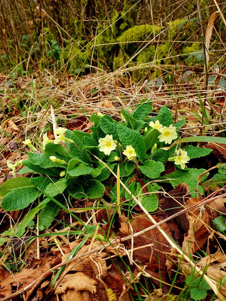
- Taking photos. When I’m walking alone, taking photos is a huge part of my walk and creates a mindful engagement with my surroundings. It could be a huge view, a moss covered tree or a tiny primrose nestling in leaves. Whatever it is, that picture can take me off course!
- I see another path that looks inviting. As soon as I see a narrow path, snaking between trees with a bend at the end of it, I want to explore that route. Which is absolutely great when you have your OS app as you can see where the path leads and how you can fit it into your route.
So when you buy your map, definitely download the free online version and mark the route out so you’re all prepared.
If you’re planning to do more hikes, go ahead and get the paid version. It’s an annual subscription of £28.99 which works out at £2.41/month. Brilliant value and no I’m not an affiliate!
Fuel
This hike starts and ends right by the lovely Cadence Cafe where you can get coffees, massive toasties, porridge etc. before or after your walk.
However a long hike is miserable when you’re hungry and thirsty so I always take provisions. I’m not a fan of ‘energy bars’. I basically think they’re a massive rip off, are often stuffed full of sugar and I don’t like all the packaging. But take them if they’re your thing! This is what I take on a long hike:
- Metal water bottle (2 if it’s summer)
- Sandwich – something high protein like chicken or salmon inside
- Walnuts or pecan nuts – great source of carbs and protein
- A hard boiled egg – my perfect superfood
- Tin of sardines – this is my emergency food. It just stays in my pack in case of need.
- Apple
- Lucozade tablets – I hardly ever need these but they’re great if youre feeling really low on energy
So that may seem too little or too much for you. (I’m small – 5’3’’). You know how much you need! Always pack a little bit extra just in case.
The Route: Enjoy!

Start and End: Cocking Car Park Grid Ref: SU 87458 16619
Bus: 60 from Chichester, get off at car park. (check out the bus timetable- only 1/hour on Sundays!)
Car: park in car park
From Cocking Car Park to Beacon Hill (2.5 hours)
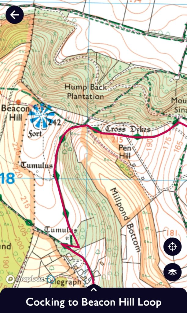
Head west along the South Downs Way, passing Cadence Cafe in about 1 minute. (If you don’t pass Cadance Cafe you’ve headed East so double back the other way!) The views are great from the start with rolling hills all around. After around 35 minutes you will reach the woods at Stread Combe, which is a beautiful wooded section and a complete change to the open path you have been travelling on. For the next 2 hours you are simply following the South Downs Way. Keep your eyes peeled when you intersect with other paths. There are a couple of points where the South Downs Way turns a corner. The path is very clearly marked but if you’re not looking it’s still easy to miss…or is that just me!
As you approach Beacon Hill (if you’re following on your OS App it’s marked by the blue 360 degree viewpoint symbol that looks like the sun!) you will find that the South Downs Way turns left. Straight ahead is another path which will take you up Beacon Hill. It’s really worth it. But if you know your knees can’t take the climb just leave it out!
Beacon Hill to Colworth Down (2 hours)
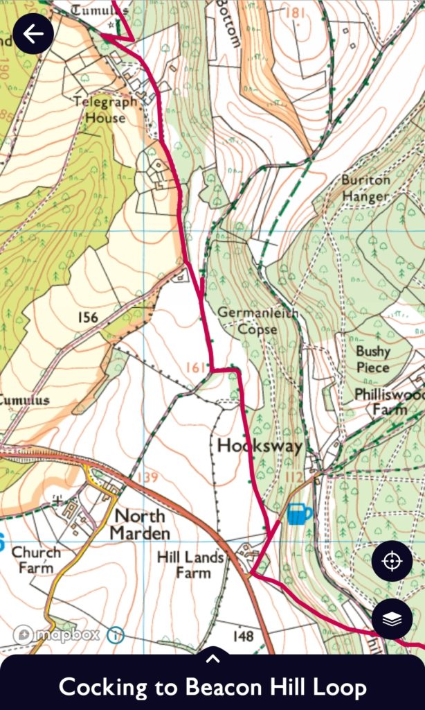
Once you’ve enjoyed the outstanding view, come down the same way you went up and carry on along the South Downs Way for a short while until you reach some woods. This is where you come off the South Downs way and start the circle back to Cocking. You will see the South Downs Way turns right. Don’t follow it. Instead turn left. The path will take you along some woods and within 5 minutes you will reach a private road that passes 3 or 4 houses. Follow the bridleway footpath clearly signposted. There’s a bit of wiggling to be done here between Telegraph House and Hill Lands Farm. See my map!
At Hill Lands Farm turn left along the path that takes you through Stubbs Copse. When you reach the road just south of Brooms Farm, take the right-left dog leg and walk along the road to Yew Tree Cottage. This is a very rural road, with hardly any traffic.
Just past Yew Tree Cottage follow the road sharp right, keeping LEFT at Staple Ash Farm along the road. Very soon the road turns sharp left. At this point ahead of you lies a huge boulder that marks the beginning of a path. Head along this path: it is basically a short cut that avoids the bend in the road and leads you to a crossroad of 4 paths at Colworth Down
Colworth Down to Cocking (45 mins)
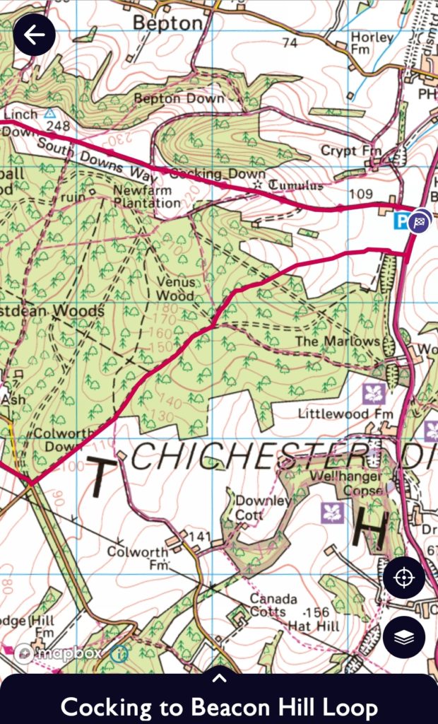
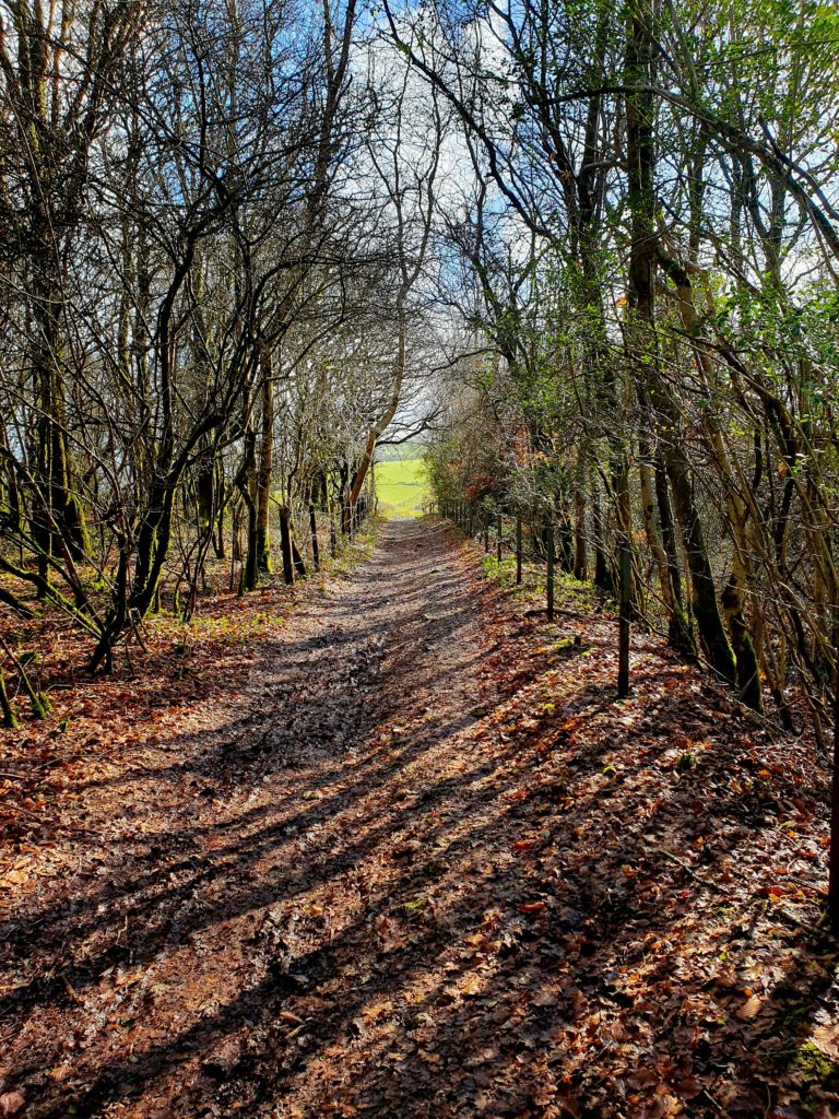
You’re almost home and dry now! This is one of my favourite parts of the route, taking you through cool dark woods almost all the way back to Cocking. Just keep walking along the main path, taking care in the area of Venus wood to follow the correct route. (See map). You should hit the A286 just 2 minutes walk south of Cocking Car Park. There is no pavement here, but space on the grass verge to walk along. This IS a busy road and cars drive fast so take care.
If you are getting the bus home check the timetable. I normally dive into Cadence Cafe if there is more than a 30 minute wait (possible on a Sunday).
About The Author
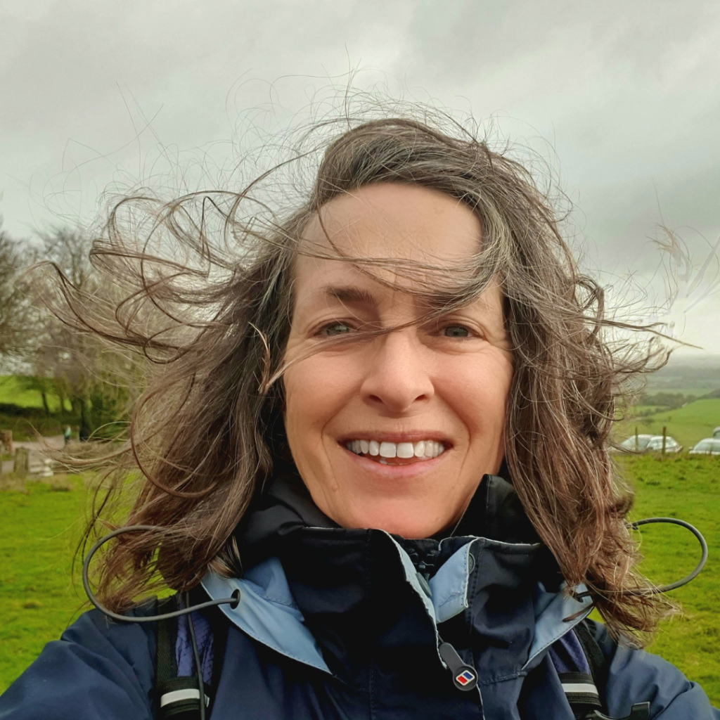
Harriet is a singer-songwriter and entrepreneur living Chichester West Sussex. She is director of children’s music business Boogie Mites and author of the upcoming book ‘Walk Yourself Wonderful: The Simple Way to A Healthy Body And A Happy Mind.’
Grab Harriet’s Free Guide: Walk Yourself Wonderful and find out how you can transform your health and wellbeing with a simple daily walk.